
Page last updated or reviewed: June 1, 2015 (review and update captions)
Since these photos were taken, Klyde Warren Park and the Margaret Hunt Hill bridge were built, both opening in 2012. As indicated in the captions, most of these images are obsolete and now serve as a historical reference of the original freeway.


High resolution
Looking east at St. Paul. The freeway here was covered with the deck for Klyde Warren Park.
(Photo date: 18-Nov-2006)
2015 Photo status:
Historical Archive
Klyde Warren Park was built over the freeway at this location.

High resolution
At St. Paul, looking northeast from the edge of the trench.
(Photo date: 18-Nov-2006)
2015 Photo status:
Historical Archive
Klyde Warren Park was built over the freeway at this location.

High resolution
The exit ramp just east of St. Paul. This ramp was removed.
(Photo date: 18-Nov-2006)
2015 Photo status:
Historical Archive
Klyde Warren Park was built over the freeway at this location and the ramp was removed.

High resolution
Looking east at Pearl, which is the east end of the trenched section. The freeway grade is steep going from the trench to the elevated section to the east: 8% on the down grade, and 7% on the up grade.
(Photo date: 18-Nov-2006)

The Hunt Oil headquarters was under construction at Akard in 2006.
(Photo date: 18-Nov-2006)

Elevated structure and connection ramps at the I-35E interchange, on the southeast side looking northwest.
(Photo date: 18-Nov-2006)

High resolution
This is the original westbound terminus of the freeway at Riverfront Boulevard, which was Industrial Boulevard at the time of this photo. The freeway was extended westward, opening in March 2012.
(Photo date: 28-Oct-2006)
2015 Photo status:
Obsolete
The freeway was extended westward to the Margaret Hunt Hill Bridge.

High resolution
A closer view of the original westbound terminus at Industrial.
(Photo date: 28-Oct-2006)
2015 Photo status:
Obsolete
The freeway was extended westward to the Margaret Hunt Hill Bridge.
High resolution
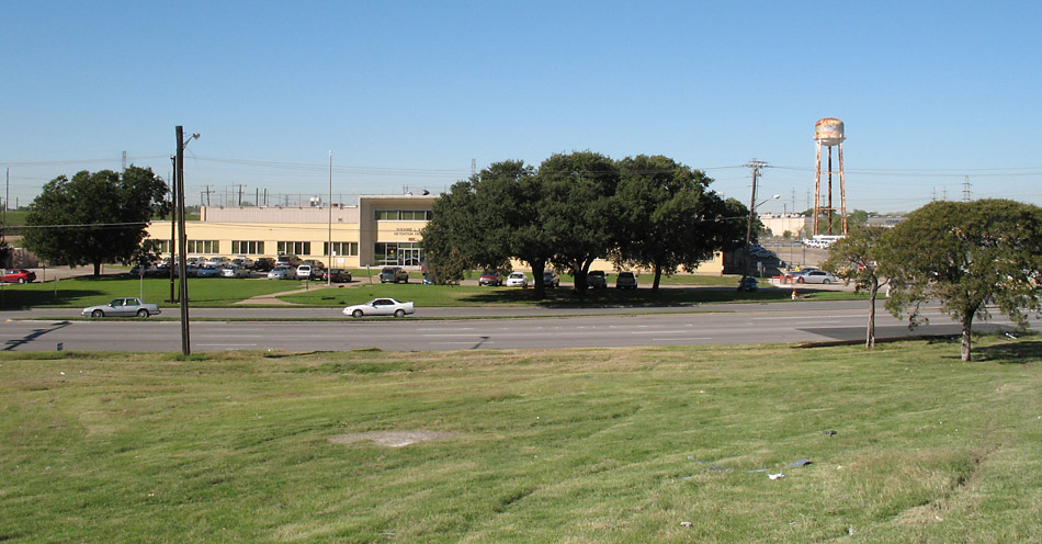
This view is on the Spur 366 right-of-way, looking west in the direction of the extension. The Suzanne L. Kays Detention Center was demolished.
(Photo date: 28-Oct-2006)
2015 Photo status:
Historical Archive
The freeway was extended westward to the Margaret Hunt Hill Bridge. The building in the background was demolished.

High resolution
This is the eastbound start of the freeway at Riverfront.
(Photo date: 28-Oct-2006)
2015 Photo status:
Historical Archive
The freeway was extended westward to the Margaret Hunt Hill Bridge and this entrance no longer exists. The building in the background was demolished.