
Page last updated or reviewed: Created December 11, 2007. Last updated June 24, 2021 (review and update captions)
2021 update: The photos below in the former Texas Stadium area have become obsolete due to construction projects completed in 2018, as noted in the image captions.

(Photo date: 27-Oct-2007)

High resolution
Looking south at Northwest Highway
(Photo date: 9-June-2007)
2018 Photo status:
Substantially Modified
Managed lanes were added to the freeway in 2018. Texas Stadium was imploded and cleared in 2010.

High resolution
Looking north from the Texas Plaza overpass in October 2013, showing the widened section of freeway which was completed in 2012. The large set-aside of pavement in the middle is for future managed lanes.
(Photo date: 3-October-2013)
2018 Photo status:
Substantially Modified
Two connection ramps, one for the managed lanes and one for regular traffic, were added in 2018.

Looking north along the northbound frontage road north of Texas Plaza in 2013. Two connection ramps to SH 114 were added.
(Photo date: 3-October-2013)

High resolution
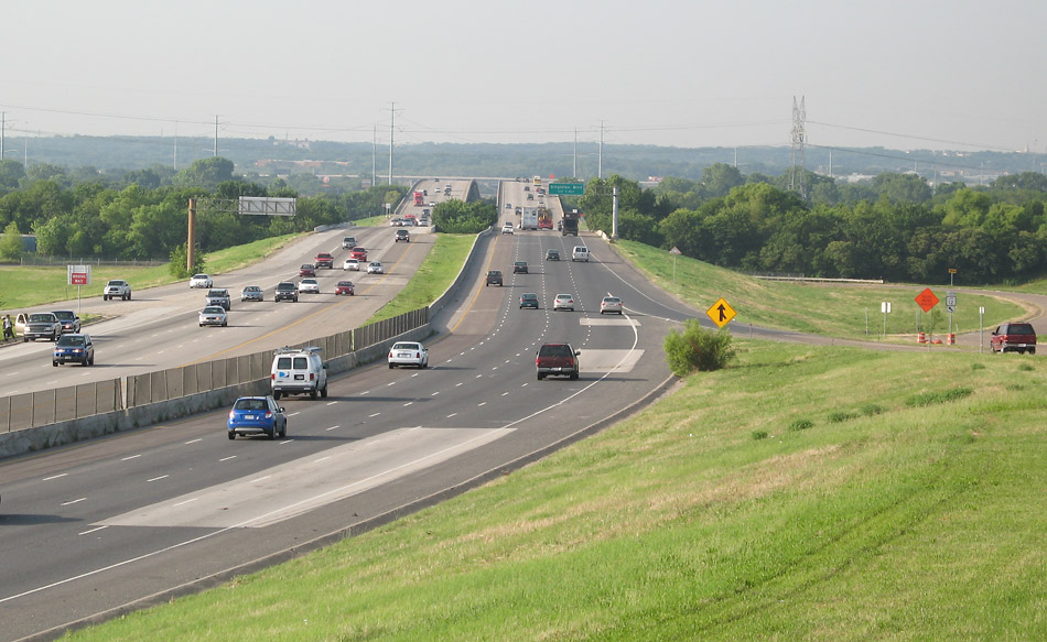
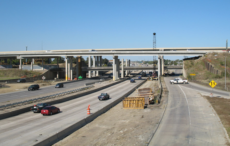
Looking south toward the interchange with TX 183, showing the original freeway. The original interchange was an antiquated loop-connector design with very poor geometrics. Phase 1 of the interchange modernization, including two connection ramps, was underway in 2015.
(Photo date: 9-June-2007)
2018 Photo status:
Obsolete
This area was totally rebuilt and expanded in 2018, including two new connection ramps. In 2021 work began on the remaining connectors at the interchange.
High resolution
Looking south at Union Bower
(Photo date: 9-June-2007)

High resolution
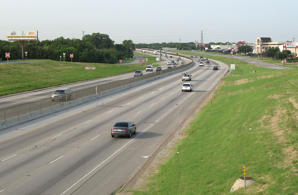
Looking south at highway 356, with the Irving Blvd crossing ahead.
(Photo date: 9-June-2007)
High resolution
Looking south at Shady Grove, with the Trinty River bridge visible in the distance.
(Photo date: 9-June-2007)
The Trinity River bridge, completed in 1976 and featuring a 52-foot clearance for barges on the planned Trinity waterway canal. Of course, the Trinity waterway was cancelled in the late 1970s.
(Photo date: 9-June-2007)

Looking south on the Trinity River bridge, with Interstate 30 visible in the distance.
(Photo date: 9-June-2007)
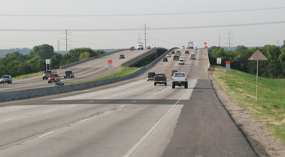
Looking north along Loop 12 at the Interstate 30 overpass. Work was in progress to rebuild the I-30 main lanes. On the date of this photo, the northbound Loop 12 frontage road was closed. The I-30 interchange is a holdover from the DFW Turnpike days, and the design of the interchange remains basically unchanged. Motorists make some highly inefficient loops to make connections between the two freeways. There are plans to construct a modern interchange, but work is not funded or scheduled as of 2018.
(Photo date: 27-Oct-2007)

High resolution
Looking north, south of I-30
(Photo date: 27-Oct-2007)
High resolution
Looking north from Davis Street. This section of the freeway was the last to be completed, opening in 1980. The design standards are higher on this relatively new section. Two new main lanes were added in 2006.
(Photo date: 27-Oct-2007)

High resolution
Looking north, south of Keeneland
(Photo date: 27-Oct-2007)

High resolution
Looking north at Illinois. The Loop 12 freeway begins here. Just ahead is the merge point with Spur 408.
(Photo date: 27-Oct-2007)