Page last updated or reviewed: Created November 1, 2007. Updated Feb 5, 2018 (review and update captions). Last updated March 24, 2018 (add photos)
2018 status: There have been substantial changes to the corridor since most of these photos were taken, including construction of the interchange at SH 121, major widening between the Bush Turnpike and Rayburn Turnpike, modification of the toll plazas, and the addition of auxiliary lanes, as noted in the affected photos.


This is the original Dallas North Tollway sign, a distinctive design called the "Circle D" which was used from the opening of the tollway in 1968 to its official retirement in 2013. However, I still seemed to see the Circle D sign after 2013 and as of 2015 I don't know if all the Circle D signs have been replaced.
(Photo date: 18-Nov-2007)

Looking north from the south side of the interchange at I-635 Lyndon B. Johnson Freeway. The tollway is on the ground level, I-635 is on the middle level, and the frontage road connections are on the upper level. Interstate 635 was widened during the LBJ Express project, completed in 2015, but the Dallas North Toll Road was minimally affected by the project.
(Photo date: 18-Nov-2007)
High resolution
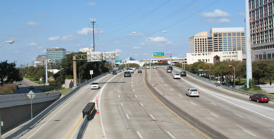
Looking north from the westbound I-635 frontage road. The tollway ahead is very narrow and very congested during rush hour. The Galleria shopping and office complex is on the right.
(Photo date: 18-Nov-2007)

Looking north, north of Spring Valley.
(Photo date: 18-Nov-2007)

High resolution
This view looks north, south of Belt Line. The toll plaza structure was modified when the NTTA toll road system became all-electronic.
(Photo date: 18-Nov-2007)

Looking north at Belt Line. The intersection at Belt Line is probably the most severely congested on the Dallas North Tollway, especially in the afternoon. The Frankford intersection is the second most congested.
(Photo date: 18-Nov-2007)

The tollway is in a narrow trench underneath Arapaho and the railroad. This view looks south toward Arapaho.
(Photo date: 26-May-2007)

Looking north at the toll plaza in Addison near Keller Springs
(Photo date: 2-Oct-2004)
2015 Photo status:
Modified
The toll plaza was removed when the NTTA system became all electronic.

High resolution
Looking south at the Addison toll plaza
(Photo date: 2-June-2007)
2015 Photo status:
Obsolete
The toll plaza was removed when the NTTA system became all electronic.

Looking south at Trinity Mills
(Photo date: 2-June-2007)
2018 Photo status:
Modified
The exterior shoulder been converted into a traffic lane.

At the Frankford intersection on January 1, 2009. Gasoline was around $4.00 per gallon in the summer of 2008 but had dropped to $1.40 per gallon due to the economic crisis and oil price collapse. Gasoline prices have not been at $1.40 per gallon since this photo, although they were around $1.75/gallon in early 2015.
(Photo date: 1-Jan-2009)

High resolution
Looking south at the Bush Turnpike interchange
(Photo date: 2-June-2007)
2018 Photo status:
Modified
The connection ramps on both sides were widened, completed in 2018.

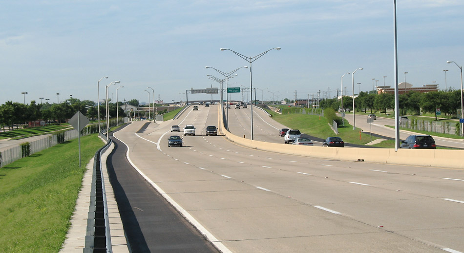
Looking north at the Bush Turpike interchange, with Plano Parkway just ahead.
(Photo date: 2-June-2007)
Looking south north of Park
(Photo date: 2-June-2007)
2018 Photo status:
Modified
This section was widened to four lanes in each direction, completed in 2018.

At the north toll plaza. The guardrail supports have rubber impact absorbers. The Dallas North Tollway is the first place I noticed this type of guardrail design.
(Photo date: 2-June-2007)
2018 Photo status:
Modified
This section was widened to four lanes in each direction, completed in 2018. Most of the toll plaza was removed when the NTTA system became all electronic.

Looking south from the Tennyson overpass. This is in north Plano at the Legacy development.
(Photo date: 3-June-2007)
2018 Photo status:
Substantially Modified
This section was widened to four lanes in each direction, completed in 2018.
High resolution
Looking north from Tennyson
(Photo date: 3-June-2007)
2018 Photo status:
Substantially Modified
This section was widened to four lanes in each direction, completed in 2018.

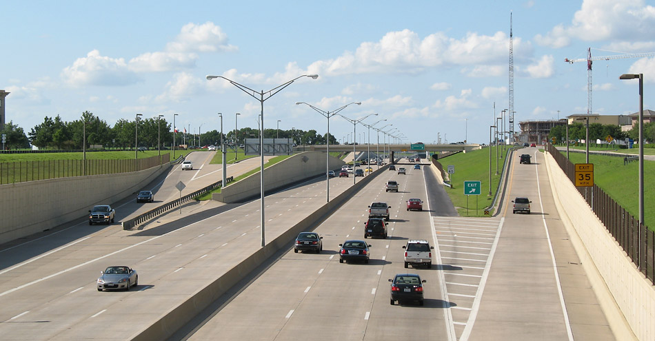
Looking south at Headquarters Drive
(Photo date: 3-June-2007)
2018 Photo status:
Substantially Modified
This section was widened to four lanes in each direction and new connection ramps from SH 121 were added, all work completed in 2018.
High resolution
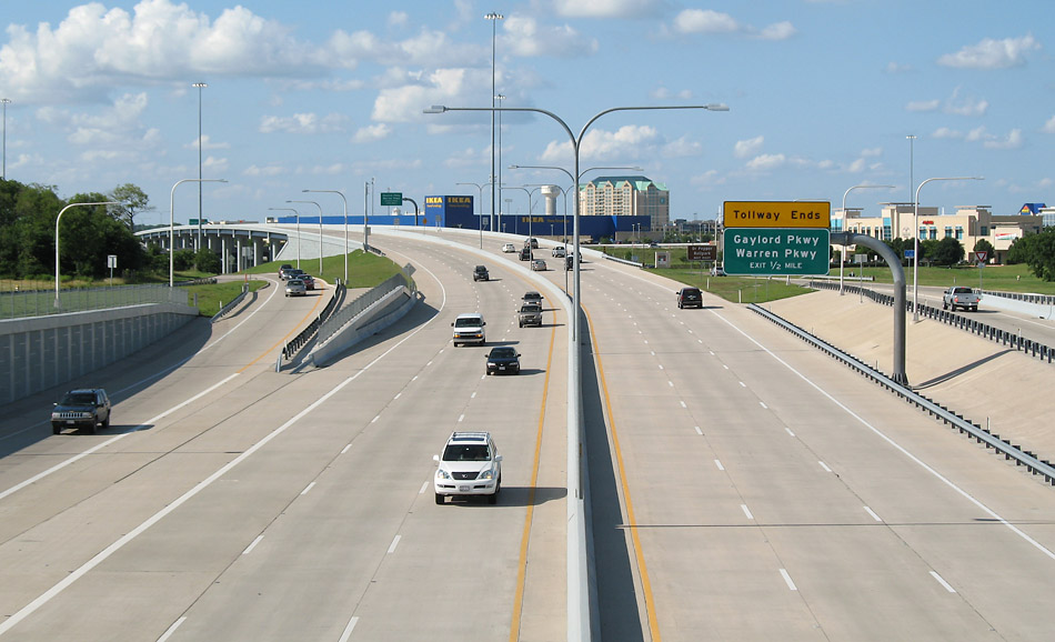
Looking north with the Highway 121 intersection ahead. At the time of the photo, the tollway ended on the far side of the overpass. The northward extension opened on September 28, 2007.
(Photo date: 3-June-2007)
2015 Photo status:
Obsolete
A five-level interchange at the Sam Rayburn Turnpike was built just ahead, opening in 2011.

High resolution
Looking north from Headquarters Boulevard toward the SH 121 interchange, which opened in 2011.
(Photo date: 19-March-2018)

High resolution
The northbound frontage road approaching the SH 121 interchange.
(Photo date: 19-March-2018)

High resolution
At the SH 121 interchange, looking north.
(Photo date: 19-March-2018)

At the SH 121 interchange, looking southwest.
(Photo date: 19-March-2018)

High resolution
At the SH 121 interchange, looking west.
(Photo date: 19-March-2018)